Memot District (Srŏk Mémót)
Memot District (ស្រុកមេមត់) is a district (srok) in Tboung Khmum Province, Cambodia. The district capital is Memot town, around 80 km east of the provincial capital of Kampong Cham by road. Memot is a border district and the city of Tây Ninh in Vietnam is 80 km away by road.
The district is easily accessed by road from Kampong Cham or Kratié. Though there are numerous smaller roads within the district that cross the border into Vietnam, there is no official international border crossing within the district. The closest official crossing is 44 km southeast of the district capital at Trapeang Phlong in Ponhea Kraek District. Memot town lies on National Highway 7 near the midpoint between Kampong Cham and Kratié.
Memot district is the most easterly district in Tboung Khmum Province and shares a border with Vietnam. Reading from the north clockwise, Memot shares a border with Preaek Prasab and Snuol districts of Kratié Province to the north. The eastern border of the district is shared with the Vietnamese Province of Bình Phước, while Tây Ninh Province of Vietnam is to the south. The western border of the district abuts Ponhea Kraek and Dambae districts of Tboung Khmum province.
Map - Memot District (Srŏk Mémót)
Map


Country - Khmer_Republic
 |
 |
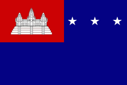
| Flag of Cambodia | |
The main cause of the coup was Norodom Sihanouk's tolerance of North Vietnamese military activity within Cambodia's borders; Vietnamese communist forces had gained de facto control over vast areas of eastern Cambodia as a result. Another important factor was the dire state of the Cambodian economy, an indirect result of Sihanouk's policies of pursuing neutrality.
Currency / Language
| ISO | Currency | Symbol | Significant figures |
|---|---|---|---|
| KHR | Cambodian riel | ៛ | 2 |
| ISO | Language |
|---|---|
| KM | Central Khmer language |
| EN | English language |
| FR | French language |